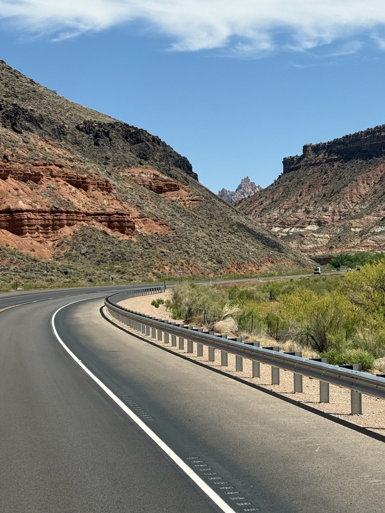
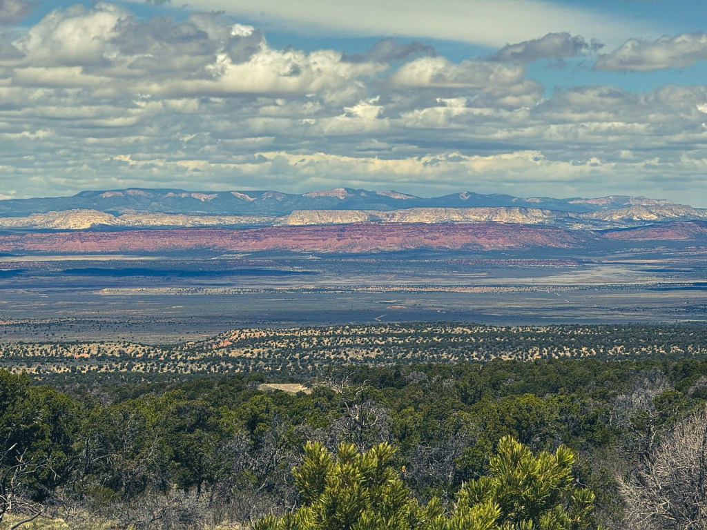
The drive from Valley of Fire to Zion National Park was stunning. We followed the Virgin River through a canyon flanked by massive cliffs and multi coloured mountains – each layer telling a story of the Earth’s geological past.
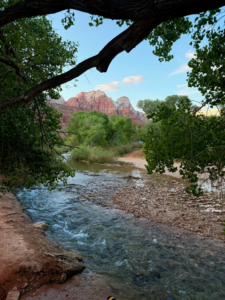
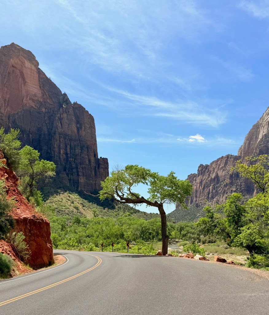
Zion NP – We think it might just be the prettiest place we’ve seen so far. The cliffs, striped like candy, were set against a surprising amount of greenery — trees and bushes everywhere, yet still dotted with cacti. The Virgin River winding its way into Zion Canyon made it all feel even more magical, like something from a storybook.
In Zion Canyon, they have a brilliant system where private cars aren’t allowed deep into the canyon. Instead, they run shuttle buses, or you can cycle. We had our own bikes, which was perfect, but in Springdale — the little town next to the park — you can rent e-bikes too. A lot of people chose this option but clearly hadn’t ridden much before, so the standard of cycling was pretty mixed!
The canyon floor led us to all sorts of trailheads and lookouts. Riding through it felt like a real privilege. We cycled all the way to the end, where the trail for the Narrows begins. The walk starts with a path alongside the river for about a mile, and then, if you want to continue into the canyon, you wade through the river, most people wearing special boots, dry trousers, and carrying wooden walking poles.
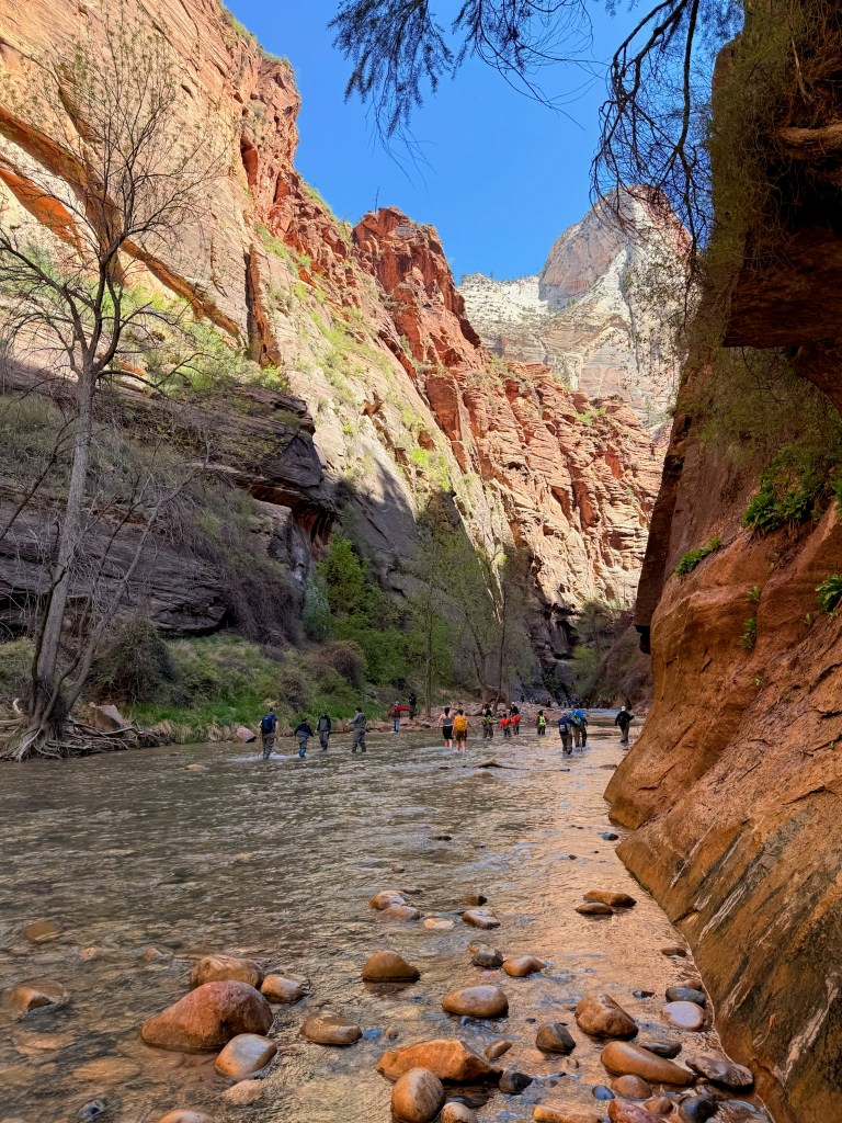
I took one look at the river section and decided it wasn’t the best idea for me — being a bit accident-prone, it looked like a perfect recipe for a twisted ankle. So instead, we were happy just to walk up to the entrance point, take it all in, and enjoy. We enjoyed stopping off at the various scenic view spots along the canyon floor. One was a good spot to see Condors; we weren’t lucky enough to see one soaring, but we saw a life size image of one; they are huge! We also saw climbers attempting some difficult climbs, it made me feel dizzy just watching them.
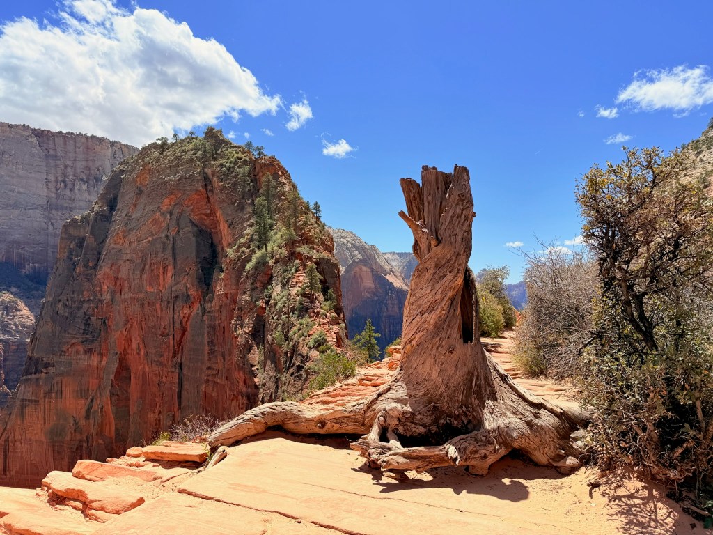
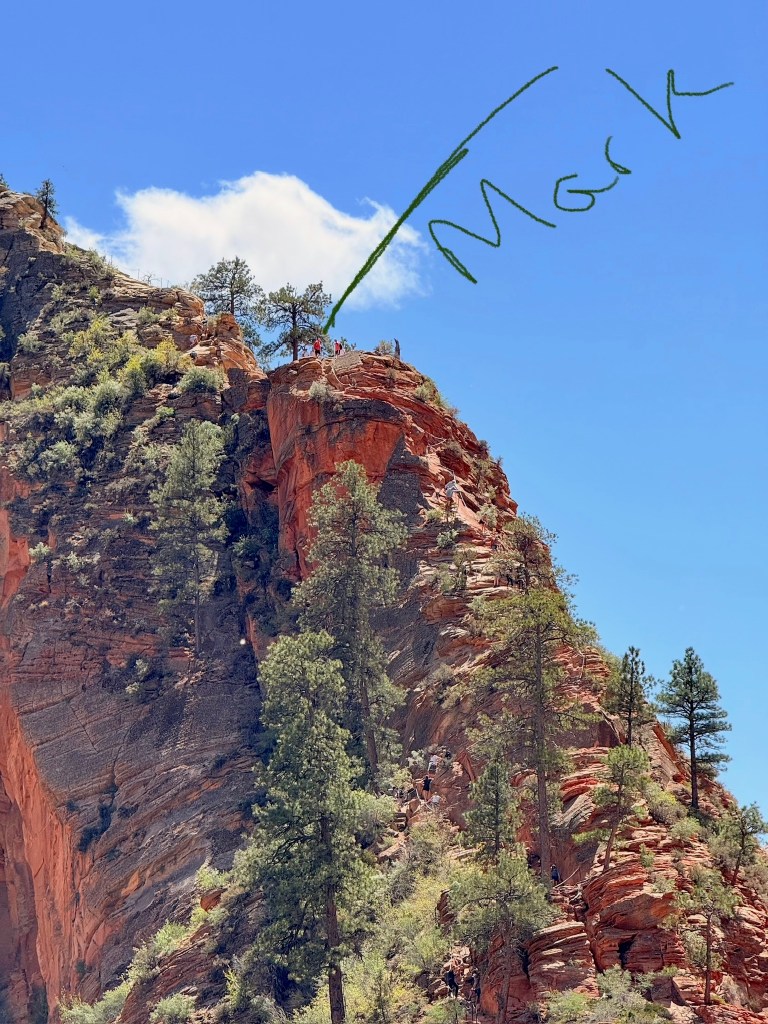
Mark thought it would be nice to do the Angels Landing hike! It is one of the most famous and iconic hikes in the USA! As I have a fear of heights, attempting something with a razor thin sandstone spine, with 1,000 feet drop offs on either side is not something I was sure I wanted to do! To do it you need a permit, a system introduced to reduce the number of people who do it, as overcrowded conditions make it unsafe. Unfortunately, we won the lottery permit system and got a permit! We both set out to do the the hike. It was a steep but straightforward hike for about 2 miles, with a surprising amount of concrete paths. Then it started to get tricky, and there were heavy duty chains to hold onto over some of the trickier sections. I rounded a bend up on to a plateau, thinking I had finished, only to see the next part, which to me, looked pretty terrifying.
I decided I had done enough; I felt ill at the thought of carrying on and encouraged Mark to complete it. I thought Mark would enjoy it more, without having me to worry about. Mark went on alone and really enjoyed it, saying the final bit wasn’t as scary as I had imagined, and I had done the trickiest part. Well done Mark!
We were due to leave Zion NP the following morning, so got packed up and were ready to travel. Then, Mark notice one of our tyres was flat. When we had the tyres replaced in San Diego and they didn’t fit one of the O rings correctly and we had lost a lot of pressure. Mark tried to re-inflate it, but the air was escaping just as quickly as he was putting it in. Eventually Mark managed to fit a new O ring, with the help of some kind fellow campers. This all took some time, so we delayed our departure by a day!
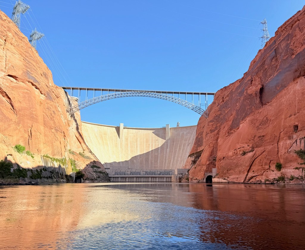
Our next adventure was booked, and it was time to get back on the road. We had decided to kayak a section of the Colorado River, through the iconic Horseshoe Bend and beneath the towering sandstone walls of Glen Canyon.
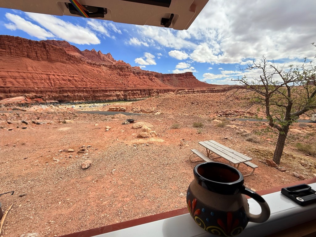
We found a great campground nearby, managed by the National Park Service. Perched above the river, it offered lovely views of the Colorado and, arriving in good time, we had our pick of the pitches. Later that day, we cycled for a recce down to the boat launch we would be using the next morning and took some time to read the historical information posted there. This spot was once a ferry crossing, used by early pioneers from 1873 until a tragic accident—when the ferry capsized, claiming three lives and even a Ford Model T. A bridge was eventually built in 1929, providing a safer and more reliable crossing.
The next morning, we were up early and on the river by 7 a.m., heading upstream on a backhaul trip to the Glen Canyon Dam. We’d been advised to start early, given that we were kayaking the full 15 miles back downriver. The ride up was fast, cold, and incredibly scenic—we marvelled at the sheer cliffs.
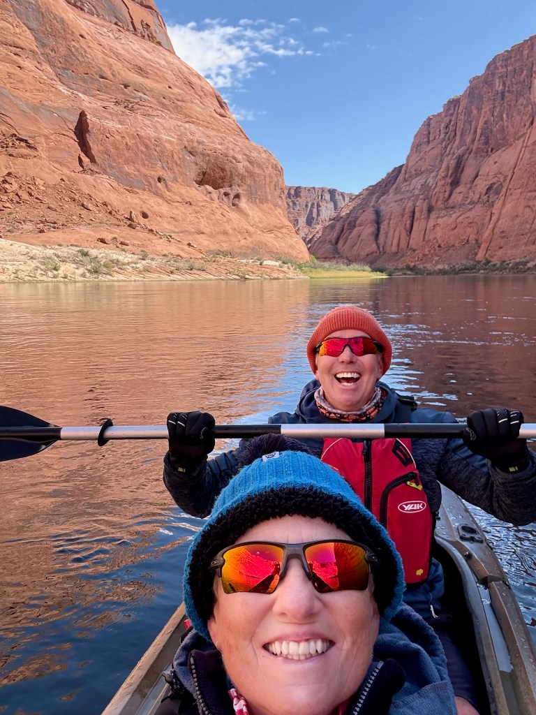
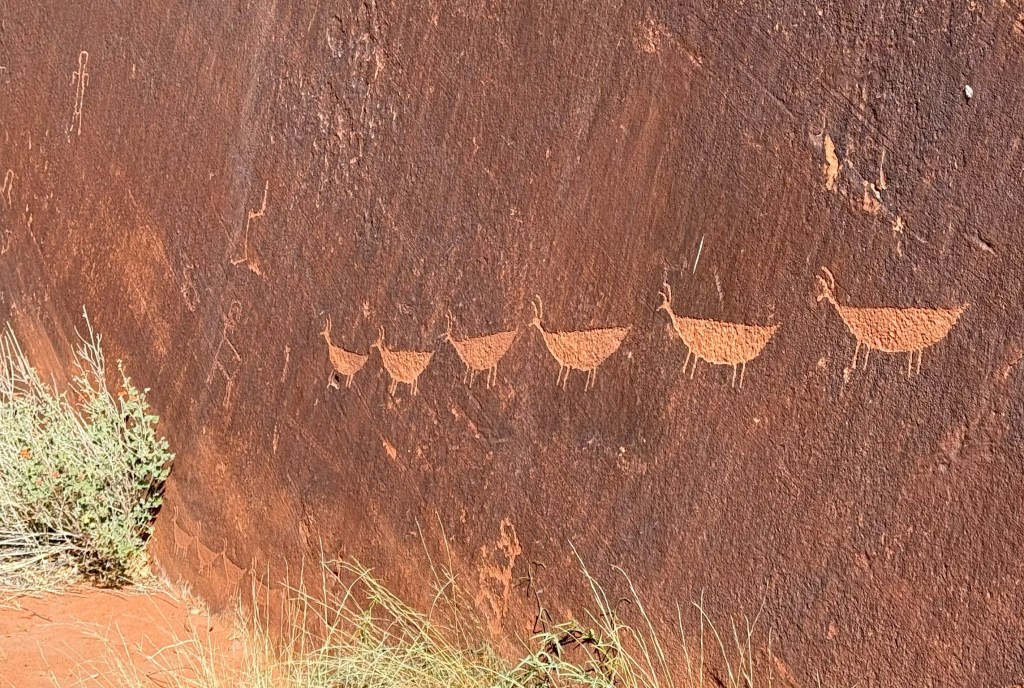
The paddle back down was fantastic, though not without its challenges. Our kayak didn’t have a skeg (a fin that helps it stay straight), which led to a few steering issues—and a few tense moments! But we soon found our rhythm and settled into the flow of the river. We made two stops: one at a petroglyph panel that depicted what looked like running bighorn sheep, and another at a small side canyon where we took a short walk.
Despite going with the current, the 15-mile journey was more tiring than we’d expected. Still, we arrived back around 2:30 p.m., realising we probably hadn’t needed to start quite so early after all!
The following day, as we made our way toward Antelope Canyon near Page, we stopped for a short hike to take in the Horseshoe Bend from above. Seeing it from both river and rim made the experience feel complete. Amazing scenery!

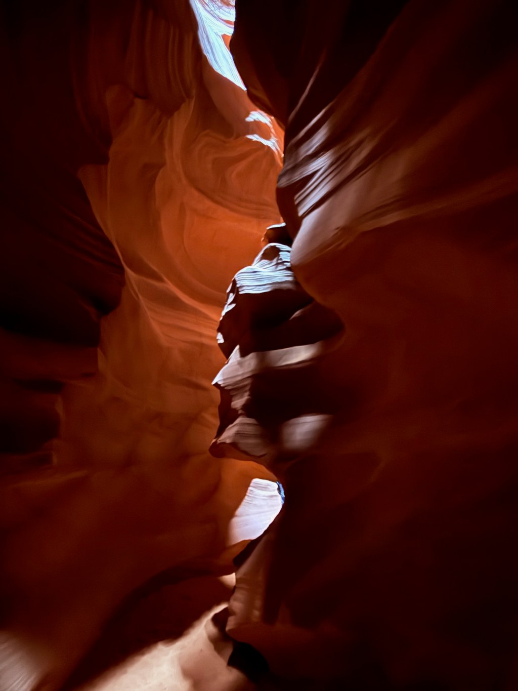
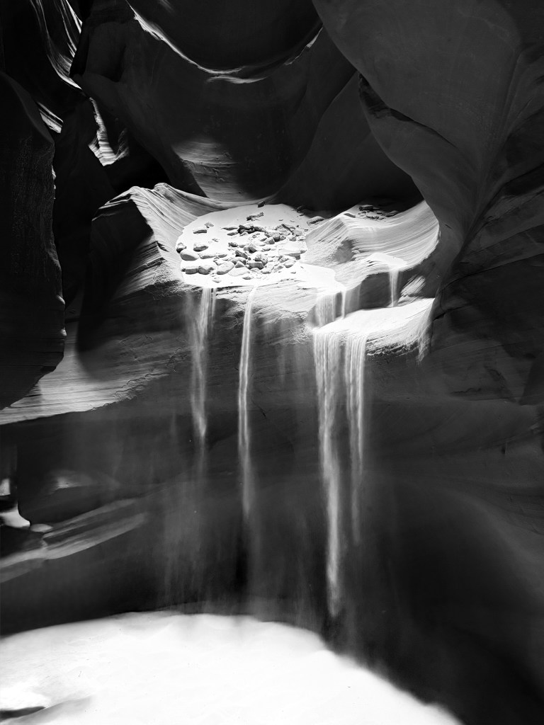
We’d seen so many photos of Upper Antelope Canyon online—it looked breathtaking. Despite the tour being quite expensive, we knew we had to experience it for ourselves. The canyon is located on Navajo land, and all tours are run by the Navajo Nation. After checking in, we boarded a small shuttle that took us along a sandy track deep into the protected area.
From the outside, the entrance doesn’t look like much—just a narrow crack in the rock wall. If you were wandering the desert on your own, you’d likely walk right past it, completely unaware of what beauty lay within. We learned that the canyon was only discovered in the 1930s by a Navajo shepherd, but it wasn’t until the 1980s and 90s that it became a major tourist destination.
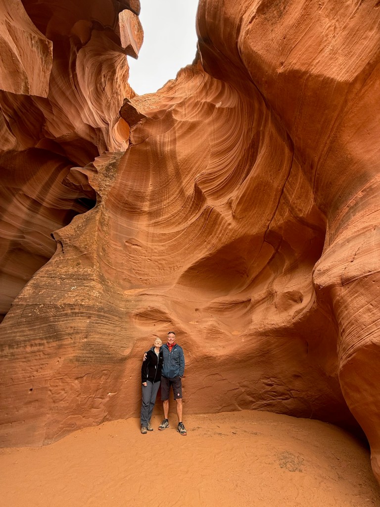
Our Navajo guide, Loretta, was good. She knew exactly where the best photo spots were and pointed out rock formations resembling things like a hummingbird, a horse’s head, and even President Lincoln. She also happily took photos of us in particularly scenic locations—something everyone took full advantage of.
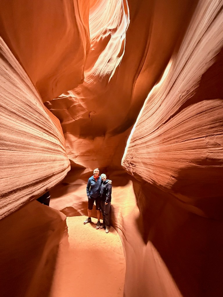
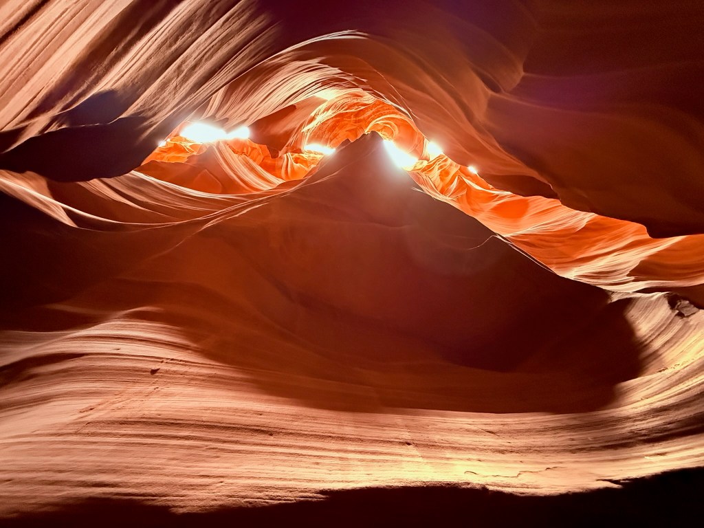
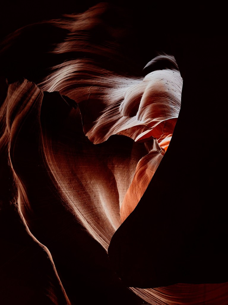
The walk through the canyon is short—only about a quarter mile—but it takes a while because you’re constantly stopping to take in the beauty around you. It felt like walking through an art gallery, every twist and turn revealing another incredible scene. We’d been told that our tour time, 10:45 a.m., was ideal because the sun would be directly overhead, casting dramatic beams of light into the canyon. Unfortunately, it was a cloudy day, but the play of light on the red Navajo sandstone was still magical. The soft bounce of light across the curved canyon walls gave it an ethereal glow.
I asked Loretta whether the canyon held any particular cultural significance for the Navajo. She said that, traditionally, it hadn’t been used for ceremonies, but that each year the Navajo hold a blessing there—for the guides and visitors. She noted that it’s not really a place meant for heavy foot traffic, and we felt lucky to have experienced it.
It’s hard to compare Antelope Canyon to somewhere like the Grand Canyon—they’re so different—but in its own way, this narrow, glowing passage through ancient sandstone was every bit as beautiful.
We spent a couple of days on the outskirts of Page, Arizona having some quiet time and hikes in the Grand Staircase – Escalante National Monument. We enjoyed seeing the Nautilus Rock, a unique white and cream sandstone feature resembling a spiralling seashell, carved over millennia by water erosion.

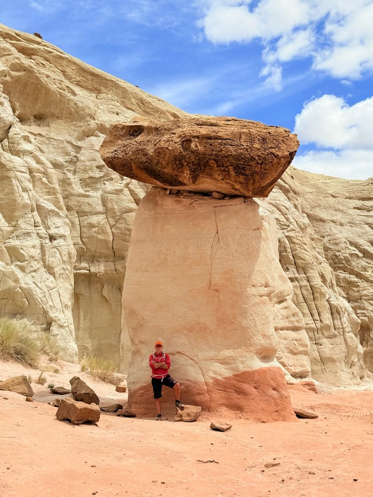
Another interesting geological feature in the area are the Toadstool Hoodoos, tall thin spires where a hard caprock sits atop softer sandstone, resembling toadstools or mushrooms; very cool to see and walk around!
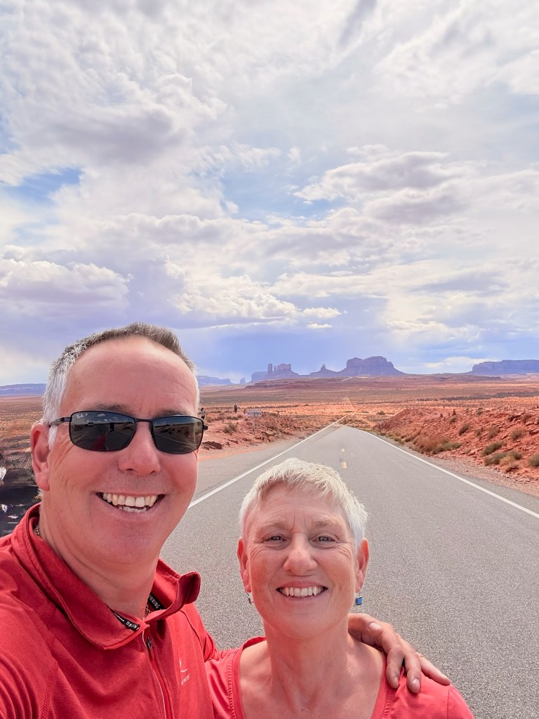
We had planned to go Bryce Canyon next, our second National Park in Utah, but the weather forecast did not look good, it was even predicting snow – in May! So we decided to change our route, because we can, and head to Moab; there was something there that Mark wanted to have a go at! Our journey there took us near Monument Valley, so we had a chance to see some of that great scenery again, and take our photo at the Forrest Gump point, the place in the movie where he decides to stop running through the USA.
Arriving in Moab felt like entering the outdoor adventure capital of America. The streets buzz with off-highway vehicles (OHVs), trail bikes, mountain bikes, Jeeps—basically anything that could climb a mountain or bounce over slickrock. It was busy, vibrant, and a little chaotic.
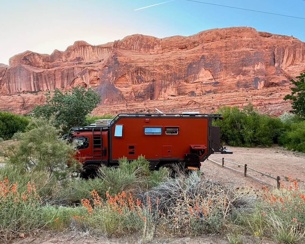
We checked iOverlander and found two budget-friendly BLM campsites. We were drawn to one called King’s Bottom, though it’s tiny and we figured our chances of getting a spot were slim. So we headed up to the Sand Flats area instead, about 4 miles out of town, but thought we could use our bikes for getting us around. That turned out to be a mistake—for us, at least. The route between there and town involved a steep hill along a very busy road packed with OHVs and Jeeps—not ideal for cycling. The campground was also jam-packed, and the surrounding hills buzzed with the sound of engines. In the end, we were relieved we didn’t find a space there.
We gave King’s Bottom a try and thought we were out of luck again—until we met a friendly man parked in a group site. He kindly invited us to join, forming a small camp of three vehicles. Peter and Millie were solo travellers, newly acquainted, but already bonded by their shared love of mountain biking.
It was a perfect day to visit Arches National Park, nice and sunny. Entry by car requires a permit—one you have to apply for months in advance, which doesn’t suit our travelling style. But this is where our e-bikes came into their own. We were able to ride straight in, no permit required, and cycle through the park at our own pace.
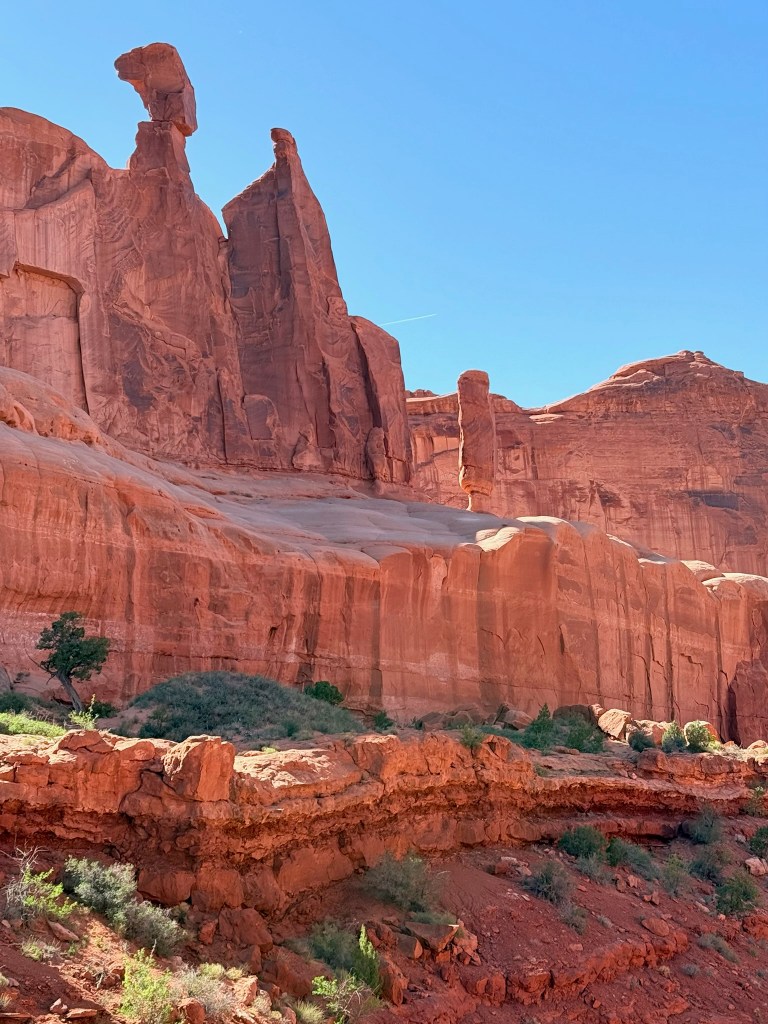
Arches is like a natural rollercoaster—constantly up and down. The e-bikes were lifesavers. Mark’s battery, however, wasn’t fully charged, so he had to ration power carefully. The park itself is breathtaking, full of dramatic rock formations and vibrant colours, though not as green as Zion. Despite the permit system to reduce car numbers, there was still plenty of traffic and, unfortunately, no dedicated bike paths—unlike Zion. We didn’t see many other cyclists, which is a shame, because slowly riding through the park felt like the best way to take it all in.
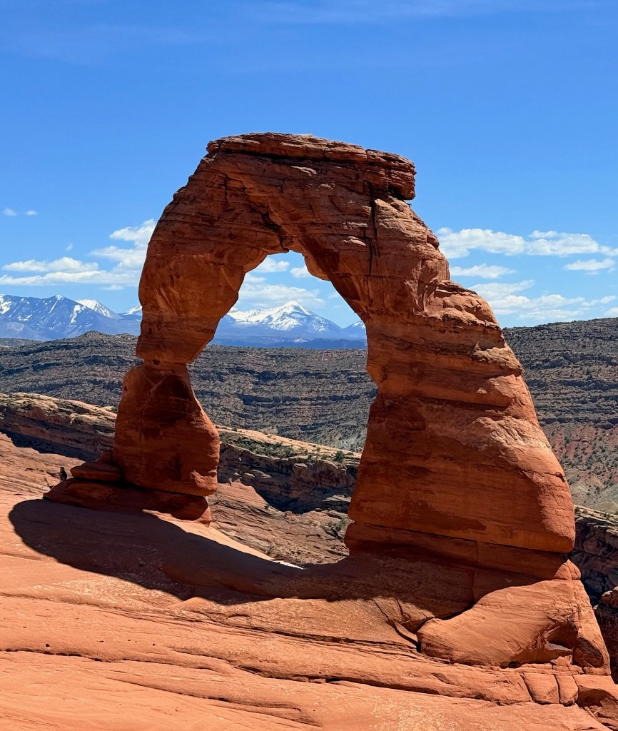
We rode to the Delicate Arch trailhead, locked up the bikes, and hiked the 3.2-mile round trip. The trail had a few steep sections and one narrow ledge, but the moment you round the final corner and see the arch—it takes your breath away. It’s completely hidden until the last moment. We joined the others for the obligatory photo, soaked in the view, and then headed back the way we came.
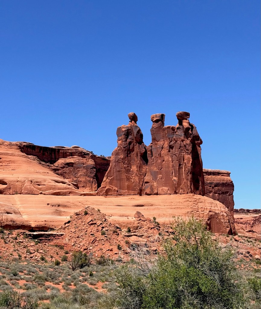
On the ride out, we stopped at Park Avenue Viewpoint, where one spire looked uncannily like Queen Nefertiti, and another—less regally—like a corn dog. It’s a beautiful spot and would be high on our list for a future hike. Mark’s battery lasted for the whole journey, thankfully, and back in town, we rewarded ourselves with a visit to Moab Brewery, as recommended by a fellow traveller. It hit the spot.
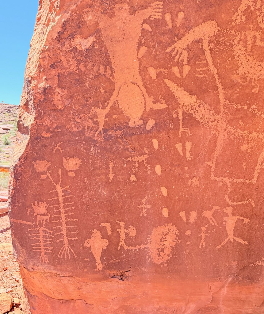
The next day was all about the OHVs. After a relaxed morning, we took the bikes up into the hills behind us. Unsurprisingly, the trails were busy with Jeeps and OHVs, but we found a quiet moment at the Birthing Panel petroglyph site—a fascinating and unusual set of rock carvings we hadn’t seen the like of before.
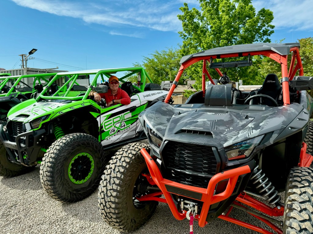
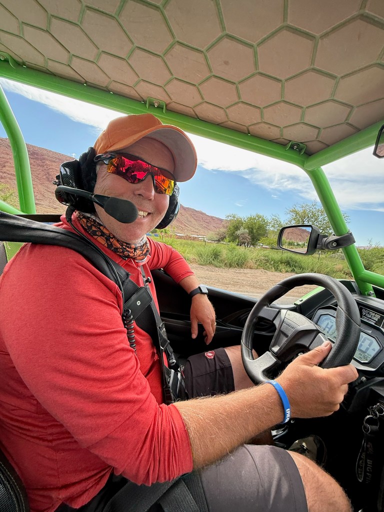
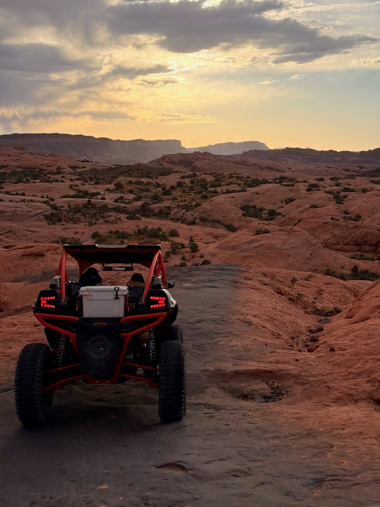
Later, we cycled the three miles back into Moab to meet our ride for the evening: an OHV from Epic 4×4 Adventures. We’d booked the sunset tour for the best light and views. Our guide, Josh, gave us a thorough safety briefing, and thankfully, Mark had some recent experience driving these types of vehicles.
We led the convoy, right behind Josh, with four vehicles in tow. After a warm-up loop on easier terrain (easier for some—still nerve-wracking for me), we headed to the Hell’s Revenge Trailhead. The route began with a dramatic climb up a narrow fin of rock with steep drop-offs on both sides. Just watching others tackle it was nerve-wracking.
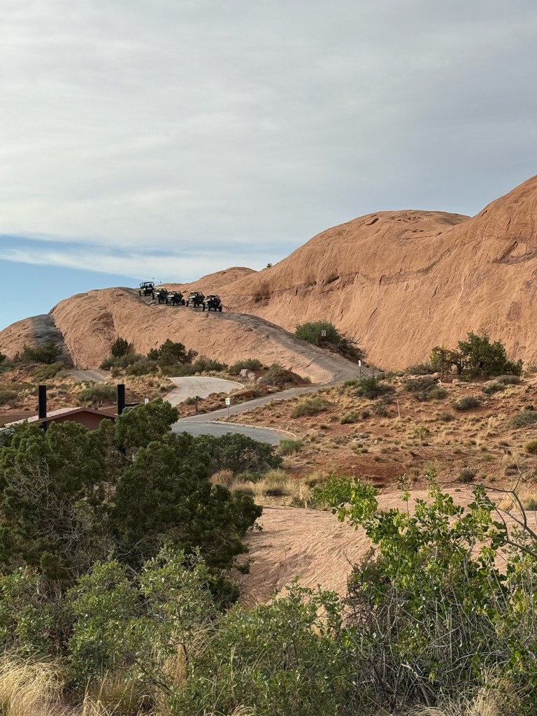
Soon it was our turn. I was nervous; Mark, on the other hand, was grinning like a kid in a sweet shop. The circuit lasted about two and a half hours, with stops for scenic viewpoints—and even dinosaur footprints. Everyone had radios, so we could hear Josh’s calm, steady instructions throughout: when to shift, which lines to follow, when to use 4WD. He was safety-focused, thoughtful, and friendly—always ready to take photos or offer tips.
By the end, I actually enjoyed it more than I expected. It’s not really my thing, but I knew Mark wanted to try it—and he absolutely loved it. If he had the chance, I think he’d drive one of those vehicles home!
After we returned the OHV, we picked up our bikes, cycled back to Moab Brewery for a well-earned drink, and then rode home. It was windy, dark, and fast—but our lights held up, and we made it back just fine.
The next morning, we packed up and headed out of Moab, heading toward Canyonlands National Park, ready for the next chapter of the adventure. We could have stayed longer at Kings Bottom, it was in a lovely position by the Colorado river and in a wide canyon, but the constant noise of OHV’s etc was too much!
