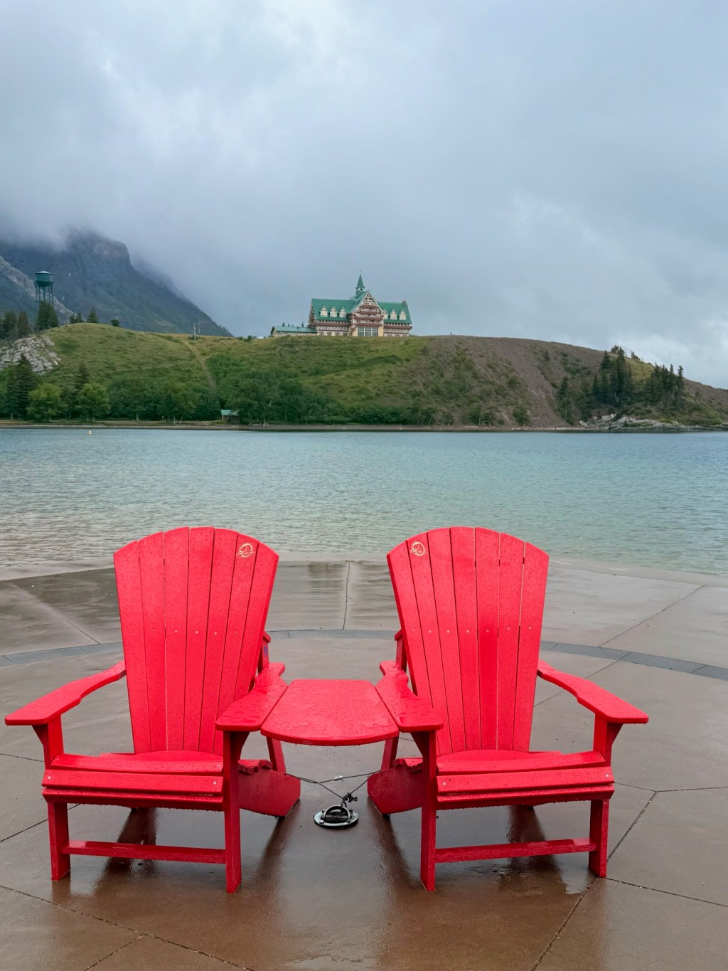
We had a restful couple of days around Waterton Lakes – mainly due to the plentiful rain and chill. It was lovely to see the familiar Canadian red chairs (Adirondack chairs) again as we strolled around the lakeside village and we admired the grand Prince of Wales Lodge, standing proudly with fine views down Waterton Lake, adding a sense of heritage and charm to the landscape.
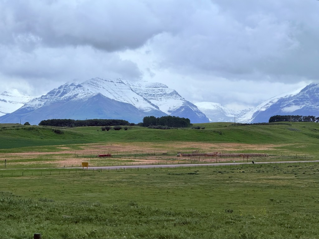
We began driving deeper into Canada. At our level, it was raining, but just a few hundred metres higher, it was snowing – the Rockies in the distance had a fresh dusting of snow, making for a very picturesque journey. Along the way, we noticed angled wooden structures by the roadside. At first, they didn’t look like fences meant to keep anything in – so we asked ChatGPT, and sure enough, they turned out to be snow fences designed to help control drifting snow. It’s these kinds of things we love learning about, and we find ChatGPT so useful.
We were still surrounded by plenty of quaking aspen trees, which we’ve come to appreciate even more now that we know they’re often part of a single, interconnected organism – it’s fascinating to see them with that in mind.
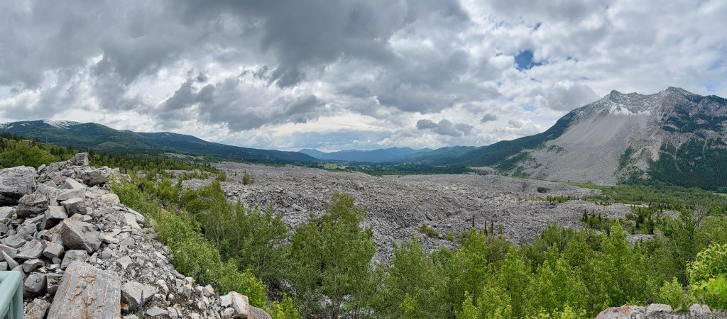
As we travelled along Highway 3, our first major stop was the Frank Slide – a haunting reminder of nature’s power. In 1903, part of Turtle Mountain collapsed, sending a massive rockslide down onto the village of Frank, tragically killing around 90 people. From above, you can still clearly see the vast grey scar – about 3 square kilometres of massive boulders, some the size of houses. It must have been absolutely terrifying, and reminded us of a terrible tragedy in the mining town of Aberfan in South Wales, my home area.
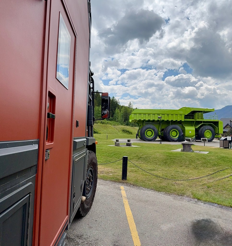
Further on, we came to Sparwood, a mining town that proudly advertises the world’s largest truck. Naturally, we had to stop. The enormous lime-green Terex Titan weighs 230 tonnes and can carry 320 tonnes – it was fun comparing it to Shaun (Shaun is small!)! We had a walk around it, read the info boards, and learned that this area mines metallurgical coal (used in steelmaking), not the kind used for heating homes. It was good to learn about it, especially since we didn’t actually see any open-cast mining on our drive, fortunately.
We drove through Elk Valley, we were lucky enough to spot an elk, along with plenty of mule deer.
After camping at Moyie Provincial Park for a night, we continued toward Castlegar. Along the way, we saw a juvenile black bear on the roadside – there was nowhere to stop safely, so we had to keep going. On the way, we passed through the town of Creston, which has lovely fruit stands selling local produce. We bought some delicious fresh produce, including something new to us – garlic scapes, which reminded me of wild garlic, which we get back in the UK. The cherries from the orchards around Creston weren’t quite ripe, but I bought some shipped in from Osoyoos; just seeing the orchards made us happy. We’ve missed this kind of landscape. It’s wonderful to see so much green again, trees full of fruit, and signs of summer growth.
At the roadside fruit stand, the shopkeeper told us about the two options to reach our next destination – take the ferry or drive over the mountain. The mountain route is Canada’s highest pass at a mile high, but with a 20-mile descent at an 8% grade, it didn’t sound ideal given Shaun’s brakes could use a little TLC. So, we chose the ferry.
The drive to the ferry was absolutely stunning. We followed the edge of Kootenay Lake – a vast body of water surrounded by tall, majestic mountains. It reminded us of home in some ways, but also of Lake Como or Lake Garda in Italy. The ferry across Kootenay Lake takes about 45 minutes and is apparently the longest free ferry in the world. The crossing was serene, with hills, forests, and calm water all around.

That evening, we camped in Castlegar and decided to take the next day off from driving. We visited the Doukhobor Discovery Centre to learn about the Russian pacifists who immigrated to Canada in 1899.
Later, we cycled along the Columbia River, passing a massive pulp mill and floating logs – a surprisingly scenic ride.
Next stop: Osoyoos – and what a beautiful place! Nestled among orange-toned hills, it sits by Canada’s warmest lake and marks the northern tip of the Sonoran Desert. We visited the Nk’Mip Desert Cultural Centre, which also hosts the first Indigenous-owned winery in the area. Of course, we stayed to sample the wine, enjoying views of the vineyards and cherry groves – two of my favourite things!

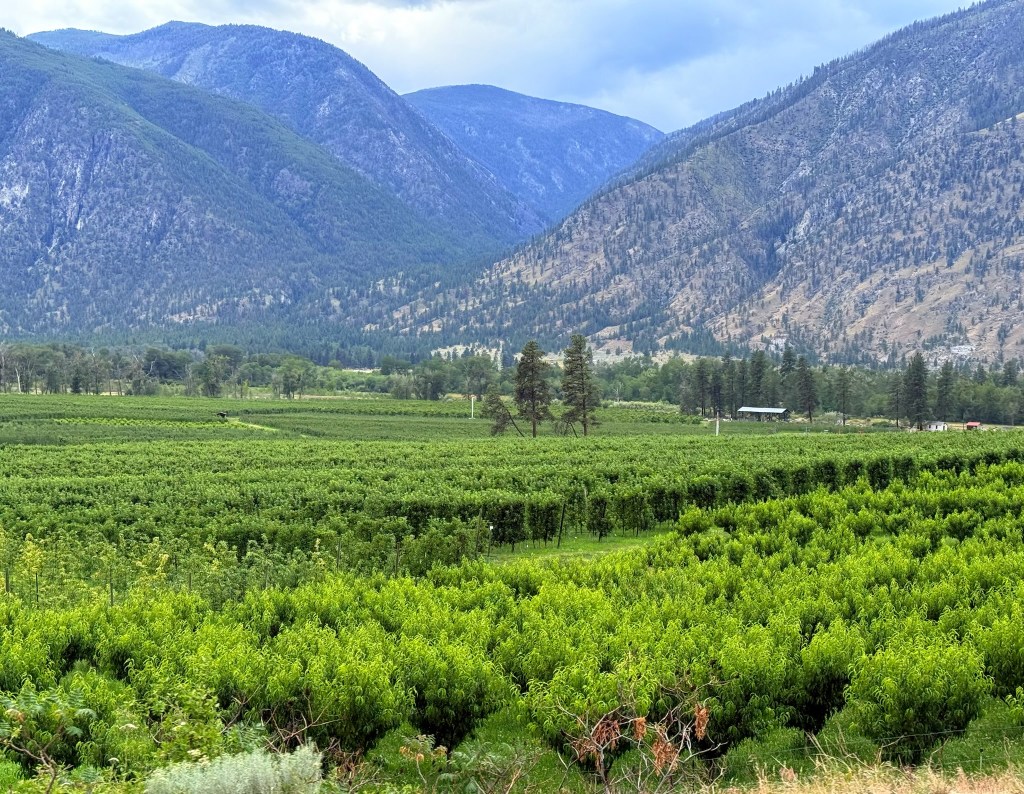
The Similkameen Valley was overflowing with produce. I’ve never seen so many cherry trees and apple orchards in one place. We picked up some lovely fresh vegetables – a bulb of Russian garlic, sweet peas straight from the pod… and yes, did I mention the cherries? Very nice cherries indeed.
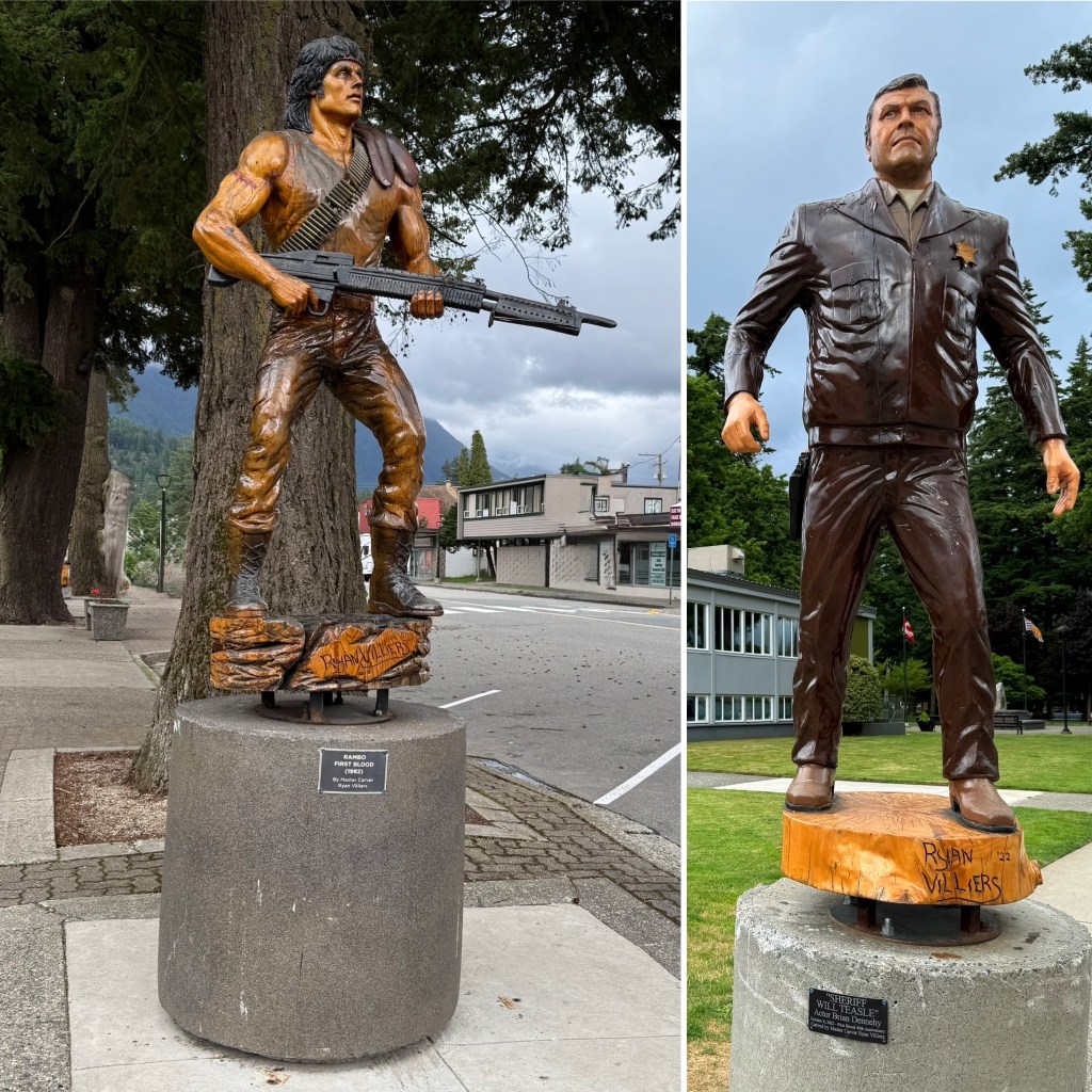
We headed on to the town of Hope, and hoped it would be a good staging point before stopping near Vancouver for some work on Shaun. It provided to be very interesting. We had booked a Harvest Host stay at the Mountainview Brewing Company. It was hosting a party for the inauguration of a new mountain bike Trail, First Blood. We had not realised that Hope was the town used for the setting of the film First Blood, Rambo’s first film. It was fun to walk around the town seeing wooden sculptures of the characters from the film and some of the filming locations. Of course, that night, after visiting the brewery, we watched the film!
So, onwards to Vancouver suburbs for Shaun to have some ‘me’ time, lol!
